Skip to content
buzardweb@gmail.com
Pinterest-p
500px
Flickr
Rss
Home
About
Categories
Animals, Aquariums and Zoos
Arabia
Archaeology
Arizona
Australia
Belgium
Birds
Botswana
Bridges and Buildings
British Museum
Bugs, Bees and Butterflies
California
Canada and Alaska
Cathedrals & Churches
Clocks and Astrolabes
Colombia
Colorado
Cooking and Recipes
Costa Rica
Decorative Arts
Egypt
Ethiopia
Events
Fashion and Shopping
Food and Drinks
France
Paris
History
Hotels and Lodges
Israel
Italy
Jewels and Jewelry
Jordan
Las Vegas
Loire Valley
London
Madagascar
Maps
Monument
Museums
Myth, Philosophy and Religion
Native Americas Cultures
New Zealand
Painting
Peru
Photographic Equipment and Techniques
Plants and Gardens
Portugal
Reims
Restaurant Reviews
Rome
Rouen and Normandy
Sculpture
South Africa
The Louvre
This and That
Travel Tips
Trinidad and Tobago
Turkey
Versailles
Vienna
Washington DC
Weapons and War
Blog
Galleries
Menu
Home
About
Categories
Animals, Aquariums and Zoos
Arabia
Archaeology
Arizona
Australia
Belgium
Birds
Botswana
Bridges and Buildings
British Museum
Bugs, Bees and Butterflies
California
Canada and Alaska
Cathedrals & Churches
Clocks and Astrolabes
Colombia
Colorado
Cooking and Recipes
Costa Rica
Decorative Arts
Egypt
Ethiopia
Events
Fashion and Shopping
Food and Drinks
France
Paris
History
Hotels and Lodges
Israel
Italy
Jewels and Jewelry
Jordan
Las Vegas
Loire Valley
London
Madagascar
Maps
Monument
Museums
Myth, Philosophy and Religion
Native Americas Cultures
New Zealand
Painting
Peru
Photographic Equipment and Techniques
Plants and Gardens
Portugal
Reims
Restaurant Reviews
Rome
Rouen and Normandy
Sculpture
South Africa
The Louvre
This and That
Travel Tips
Trinidad and Tobago
Turkey
Versailles
Vienna
Washington DC
Weapons and War
Blog
Galleries
Search
London
Home
»
London
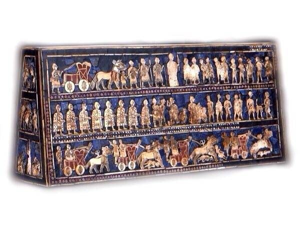
Chariots, The First Wheels of War
March 1, 2014
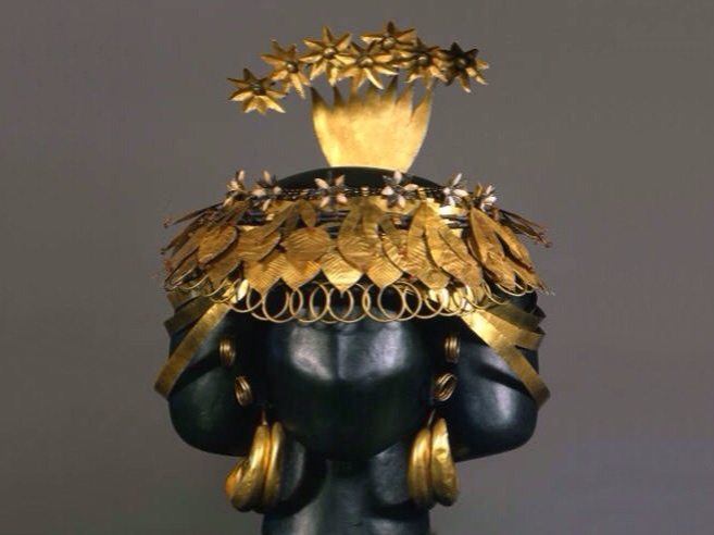
Queen Pu-abi of Ur. British Museum, London
February 23, 2014
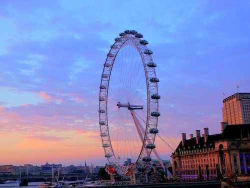
Queen’s Walk. South Bank Thames, London
July 4, 2013
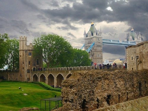
The Tower of London, London
July 2, 2013
Oxo Tower Restaurant, London
July 1, 2013
The Egyptian Lion and Cat Goddesses: Sekhmet, Bast and Mut. British Museum, London
November 11, 2012
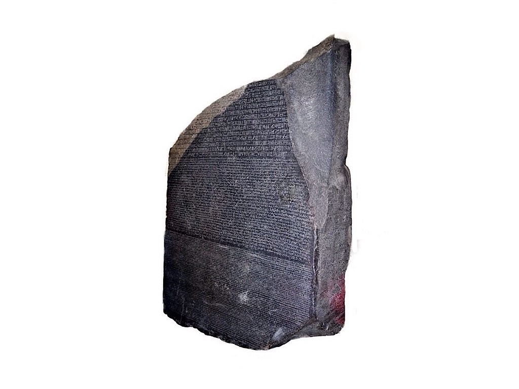
The Rosetta Stone, British Museum, London
October 22, 2012
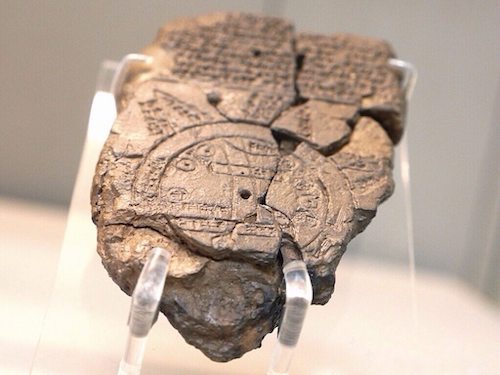
Babylonian World Map, British Museum, London
October 9, 2012
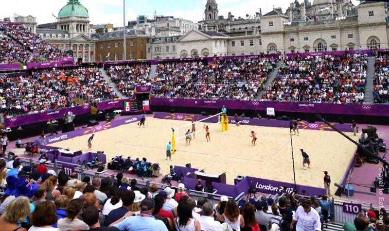
Beach Volleyball, London Olympics 2012
August 11, 2012
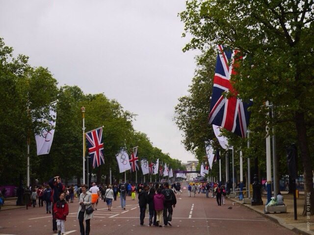
The Olympics 2012, London, England
July 31, 2012