I made a decision to go on a safari, mainly to practice wildlife photography and Botswana was one of the choices. Botswana, officially the Republic of Botswana, is a landlocked country, about the size of France, located in Southern Africa. Botswana is topographically flat, with up to 70 percent of its territory being the Kalahari Desert. It is bordered by South Africa to the south and southeast, Namibia to the west and north, and Zimbabwe to the northeast. I spent most of my time there cursing the heat and bugs (and by the way the day I was born) but came away with surprising lovely memories of the country. I hope you too will realize the beauties of this desert oasis by the end of this post
Botswana

A mid-sized country of just over 2 million people, Botswana is one of the most sparsely populated countries in the world. Around 10 percent of the population lives in the capital and largest city, Gaborone. Botswana boasts a GDP (purchasing power parity) per capita of about $18,825 per year as of 2015, which is one of the highest in Africa. Part of the prosperity comes from Botswana’s Orapa mine, the largest diamond mine in the world in terms of value and quantity of carats produced annually. Jwaneng, meaning “a place of small stones”, is owned by Debswana, a partnership between the De Beers company and the government of Botswana. It is the second newest of four mines operated by the company, having begun operations in 1982. Another significant source of income is obvious from the map, ecotourism.
Elephants


Botswana has the greatest elephant population in Africa with numbers exceeding 50,000. The highest concentration of elephants can be found in the Chobe National Park and Linyanti region. It is not uncommon during the dry winter months to see the floodplains of the Chobe River and Linyanti literally covered with Elephants. In the past it was said by many ecologists that Botswana had an ‘Elephant problem’ in that there were too many Elephants for the vegetation to support. It is true that the Elephants have changed the landscape of places like the Chobe River from thick woodland to open plains. As the Elephants move to the permanent water areas during the dry season the vegetation takes a hammering.


Colophospermum mopane, commonly called mopane, mophane, mopani, balsam tree, butterfly tree, or turpentine tree, is a tree in the legume family (Fabaceae), that grows in hot, dry, low-lying areas, 200 to 1,150 metres (660 to 3,770 ft) in elevation, in the far northern parts of southern Africa. The tree only occurs in Africa and is the only species in genus Colophospermum. Its distinctive butterfly-shaped (bifoliate) leaf and thin seed pod make it easy to identify. The elephants love this plant, as a result they grow only only to a short height and groups of them are called elephant vineyards due to the resemblance to actual grape vines in a vinyard.
Water
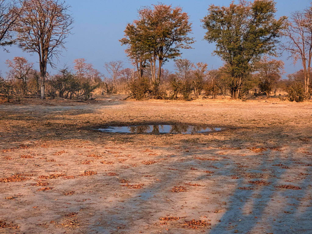
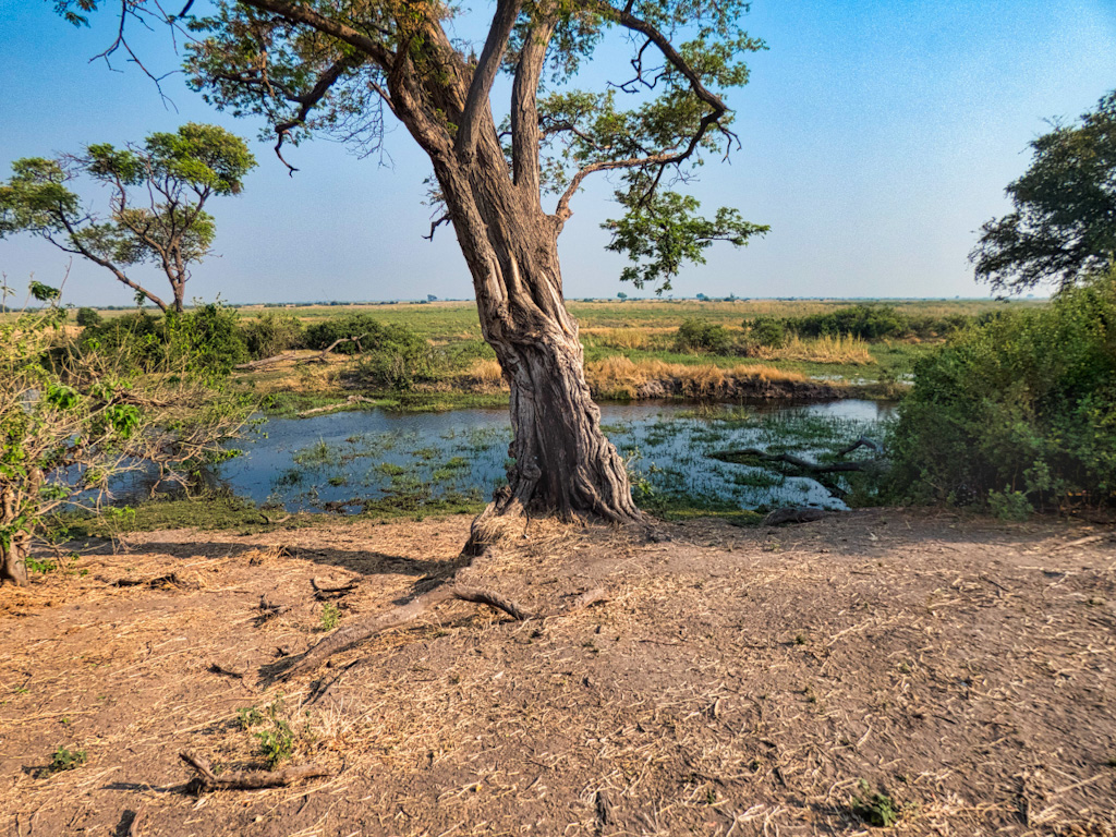
At this point you might well ask why we decided to visit Botswana at the end of the summer when the combination of heat, lack of rain and elephants had rendered the landscape beat up to say the least. It’s all about water in Botswana. In the green season there is water all over the land. In the dry season this gets limited more and more to only permanent water sources such as rivers and lagoons and very large waterholes. Of course the animals need water to survive, so they are forced to congregate closer to these guaranteed water sources as the dry season continues. This goes especially for the larger mammals. If you visit during the rainy season of April and May, the foliage obscures the view of many of the animals and rather than a few it might be enoughwaterholes, there are many sources of water that disperse the animals. Moreover, the toads used to get to the animals become a morass of mud. Thus, at least in the drier areas, a choice must be made between viewing the animals and observing a lush landscape. Moreover, especially in the northern part of Botswana, the water table is relatively high and waterholes combined with tough, resilient vegetation continue the cycle of life.
Beauty in the Desert
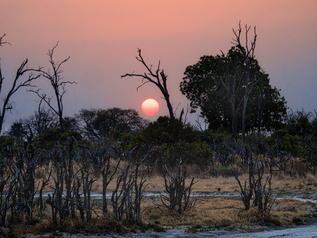
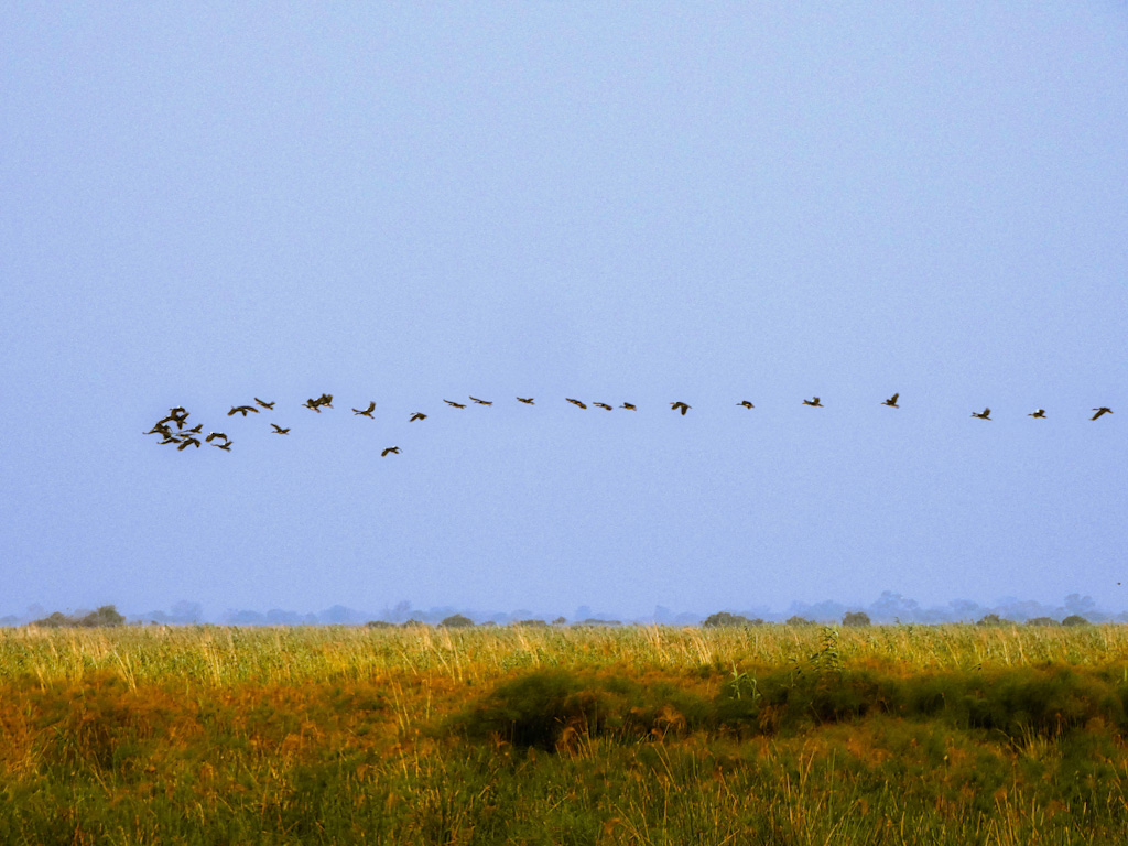
Despite the desolation, there is beauty in the landscape. Deserts have a beauty of their own. If this were all, it might be enough since my loyal readers know that I have an affection for desert landscapes. However, Botswana has a pearl in the center of the Kalahari Desert, the Okavango Delta. Swollen with floodwaters from the summer rains, the Okavango River travels from the Angolan highlands, crosses into Botswana at Mohembo in the Caprivi, then later spills over the vast, fan-shaped Delta. The timing of the floods is uncanny. Just as the waters from Botswana’s summer rains disappear (April, May), so the floodwaters begin their journey – 1300 kilometres of which is through Kalahari sands – revitalising a vast and remarkably diverse ecosystem of plant and animal life. Nowhere in Botswana sees a more striking transformation than the Kalahari. Indeed, it is during the Green Season that this usually inhospitable semi-desert comes alive. Lines of wildebeest and zebra wind their way onto the Makgadikgadi grasslands; buffalo and elephant – incongruous in this semi-desert setting – arrive at Nxai Pan National Park while the Central Kalahari Game Reserve, home to huge herds of springbok, echoes to the sounds of contented fat-bellied lions and cheetahs.
Okavango Delta


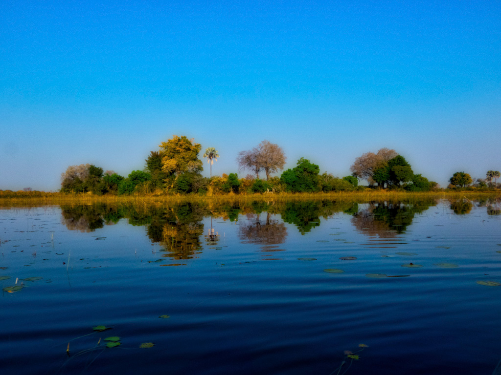
The Okavango Delta is situated deep within the Kalahari Basin, and is often referred to as the ‘jewel’ of the Kalahari. That the Okavango exists at all, deep within the Kaliyari desert, seems remarkable. Shaped like a fan, the Delta is fed by the Okavango River, the third largest river in southern Africa. It has been steadily developed over the millennia by millions of tons of sand carried down the river from Angola. The amazing fact of the Delta is that the Okavango river water disappears into the sands of Botswana, never to be seen again.
Dry and Wet Safaris

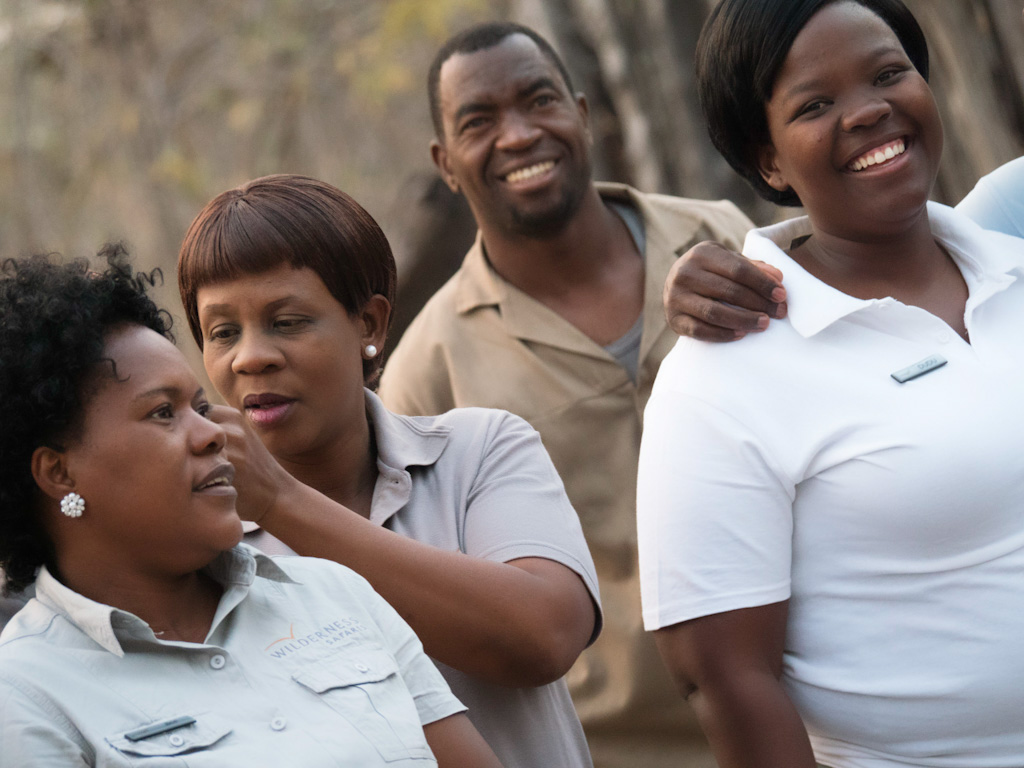
In northern Botswana, the ‘wet season’ occurs from November to around April. This is when the rains come, usually in the form of dramatic afternoon thunderstorms, precluded and followed by bright sunshine and heat. High water season in Okavango, though, occurs when the flood waters from Angola slowly fill the delta, usually from May/June into August/September. This is the ‘dry season’, climatically, but the flood season for the delta. Safaris are traditionally split between the drier area outside the Delta and the flooded areas within the the Okanago Delta. Thus the guest is treated to the concentrated large mammals and carnivores of the dry delta and the bounty of the birds and plants of the delta. The logistics of getting guests to the camps on private planes, feeding them, providing passable roads and bridges with working vehicles are formidable and account for the relatively high cost of these expeditions, typically over a thousand dollars a day. Despite the cost, a safari experience can truly be a life changing experience with memories that will last a lifetime.
Botswana

It is rare to find a country in Africa that is not facing a famine and/or a constitutional crisis. In June 1964, the United Kingdom accepted proposals for a democratic self-government in Botswana. The seat of government was moved in 1965 from Mafikeng in South Africa, to the newly established Gaborone, which is located near Botswana’s border with South Africa. The country held its first general elections under universal suffrage and gained independence on 30 September 1966. Surface water is scarce in Botswana and less than 5% of the agriculture in the country is sustainable by rainfall. In the remaining 95% of the country, raising livestock is the primary source of rural income, primarily because of the destructive influence of elephants. Approximately 71% of the country’s land is used for communal grazing, which has been a major cause of the desertification and the accelerating soil erosion of the country. Since independence, Botswana has had one of the fastest growth rates in per capita income in the world, surpassing South Africa. Botswana has transformed itself from one of the poorest countries in the world to a middle-income country. Although Botswana was resource-abundant, a good institutional framework allowed the country to reinvest resource-income in order to generate stable future income.
References: