
I stumbled on a really great blog on places in and around Death Valley by a guy named Steve Hall, aptly named “Death Valley Adventures”. His blog is particularly great because there are few maps and/or information on most of the area surrounding Death Valley. It encouraged me to do a little exploring on my own. I decided to drive home from Los Angeles to Las Vegas on the Fourth of July through the Searles Valley, Panamint Valley, Death Valley to Furnace Creek Inn and then on home. These valleys are between the Argus, Slate, and Panamint Ranges which are oriented north-south, or toward the north-northwest. The El Paso Mountains, Spangler Hills, Straw Peak in the Slate Range, and Quail Mountains are oriented east-west, and the Owlshead Mountains are arranged in a semi-circular pattern south of the valleys. Aside from the geology, there are some interesting places to see along this little drive and of course some of our beautiful desert flora. Admittedly it extended the trip home by a few hours but the scenery was worth the lost time.
Little Petroglyph Canyon

Part of the reason that I decided on this road trip revolved around a visit to Little Petroglyph Canyon that I made in the Coso Mountain Range. Because the canyon is located on the Naval Air Weapons Station designated area, you are not allowed to take pictures of anything outside of the canyon. I thought that the area was very interesting, with engaging history, geology and plant life and thought I would like to photograph the surrounding area. I am also particularly interested in the life of the Native Peoples in this area, the Timbisha Shoshone Tribe, and wanted to better acquaint myself with the landscape.
Argus Range


Poison Canyon

Salt Wells Canyon or Poison Canyon was the route of the 20-mule teams that hauled borax from Searles Lake to San Pedro. On the north side of the canyon near the east end is “Fish Head Rocks” which were originally called “Whale Heads.”


The “Fish Rocks” are at the east end of Poison Canyon, and the decoration or graffiti has been there since the 1930s, some accounts say 1928. The road used to go right past the rocks, but later the road was re-aligned and now is about a 100 yards or so away from the rocks, although they can still clearly be seen from the road if you’re driving to Trona.
Desert Holly

Desert Holly, is silvery-whitish-gray shrub in the goosefoot family, Chenopodiaceae, native to desert of the southwestern United States. It is the most drought tolerant saltbush in North America. It can tolerate the hottest and driest sites in Death Valley, and remains active most of the year. The leaves accumulate salts which helps to extract water from the soil when other plants cannot. The salt is then shed by dropping the leaves.
Creosote Bush

The Creosote bush is a prominent species in the Mojave, Sonoran, and Chihuahuan Deserts of western North America. The plant is extraordinarily tolerant of drought, saline or alkaline soils, and adapted to desert conditions. It reproduces by seed and also by sending up new shoots from the roots. The latter results in the creation of clonal rings. The “King Clone” creosote ring is one of the oldest living organisms on Earth. It has been alive an estimated 11,700 years, in the central Mojave Desert near present-day Lucerne Valley, California. By measuring the diameter of the ring, its total age could be estimated. It is within the Creosote Rings Preserve of the Lucerne Valley and Johnson Valley. These leaves are especially pungent after a rain, and have been used as antiseptics and emetics by native peoples. Its foliage provides refuge for crickets, grasshoppers and praying mantids.
Blue Palo Verde


Palo Verde Trees commonly occur in the Southwest: the Foothill, Yellow or Littleleaf Palo Verde (Parkinsonia aculeata ) and the Blue Palo Verde (Parkinsonia florida). Palo verde – Spanish for green wood or stick – alludes to the plant’s greenish branches and trunk. It is characterized by its short, divided leaves, with between four and eight leaflets (the other two species have more leaflets). Like other leguminous desert trees, both species of Palo Verde produce edible flowers and seeds (but many find the Foothill seeds to be sweeter). The trees generally flower in late April through May and then set green seed pods a few weeks after. The green pods will dry in June-July. Both green and dry pods can be harvested, and eaten, preferably before the summer monsoon rains start.
Searles Valley


Searles Lake is a huge resource of sodium and potassium minerals of the carbonate, sulfate, borate and halide classes of mineralogy. Industrial minerals are extracted from the brines at the Argus, Trona and Westend plants. Minerals are crystallized from the brines, screened, washed, and dried. Commodities produced by Searles Valley Minerals from their Searles Lake operations include borax, V-Bor (borax with five moles of water), anhydrous borax, boric acid, soda ash, salt cake and salt. Mineral reserves exceed four billion tons. It was a little amazing to be standing at this particular location which was almost the epicenter of the July 4 earthquake. The top picture shows the cloud of dust kicked up by the earthquake from a giant mound of borax. The second picture was taken just a few seconds later and shows the huge pile of borax.
Trona


Today one of Trona’s main sources of income is still mining operations. On March 18, 2004, all operations of IMC Chemicals were sold to Sun Capital Investments and the operations in Searles Valley was renamed “Searles Valley Minerals, Inc.” The small desert town of Trona holds a lot of history and offers modern living at an affordable price. Over the years not only has Trona preserved its history, it has also grown and changed with the times. When we arrived, there were aftershocks from the earthquake and the power was out. Moreover, the stores were closed since all of their goods were now on the floor. We had hoped to get gas and some supplies but with everything closed, we decided to go to the Panamint Springs resort.
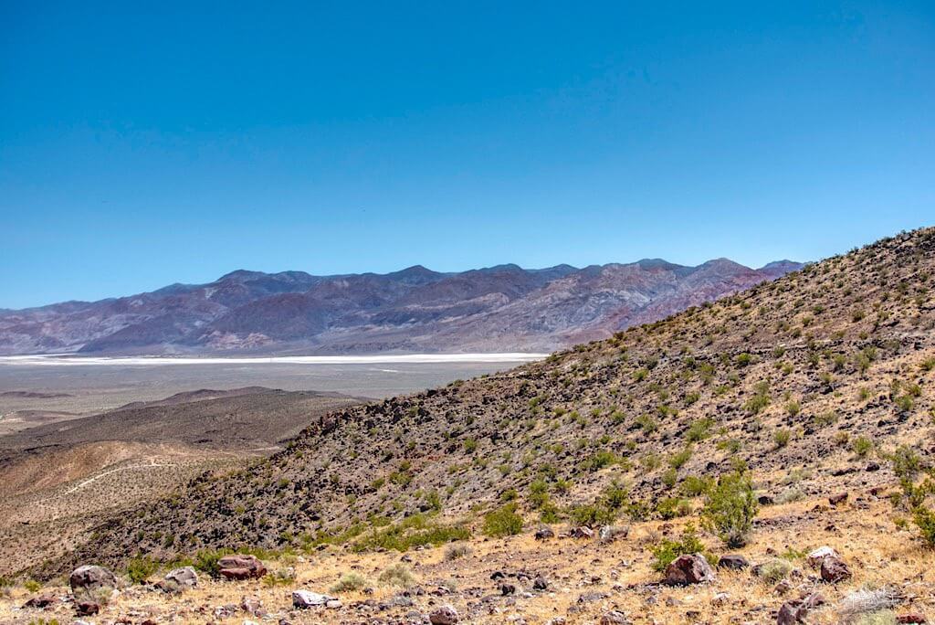
Panamint Valley


We didn’t visit Ballarat but I took a picture of it from the highway. Today, Ballarat is a virtual ghost town with a single occupant. As of June 2013 Rocky Novak and his dogs, Potlicker and Brownie, live in the town. Rocky runs the general store on afternoons and weekends to supply tourists, and is working on repairing the water pipes that supply the town, for which he is paid by the government. It was founded in 1897 as a supply point for the mines in the canyons of the Panamint Range. A quarter-mile to the south is Post Office Springs, a reliable water source used since the 1850s. George Riggins, an immigrant from Australia, gave Ballarat its name when he proposed it should be named for Ballarat, Victoria. In the 1960s, Charles Manson and the “Manson Family” of killers moved into a ranch south of Ballarat, and left graffiti in the town. The 1969 movie Easy Rider has a scene filmed in Ballarat.
Townsend Pass


Because of the earthquake and subsequent power loss, we could not get gas in Trona and made a slight detour to Panamint Springs Resort which has gas pumped by generators. Just up the road from the resort is a canyon with Darwin Falls, which I wrote a post about a couple of years ago. Also, although it doesn’t look like much, the Panamint Springs Resort has really good food and in particular steaks.
Desert Broom


Desert Broom is one of those plants you will immediately recognize in the desert because it is so green. It is a vertical, evergreen, densely-branched shrub usually 3 to 6 feet tall (0.9–1.8 m), occasionally to 10 feet (3 m). The many fine twigs are green and the tiny, linear leaves fall off during dry periods. Desert broom is so-called because the native people of the southwest tied leafy branches together for use as a broom. They also made arrows from the larger branches. Also, the Seri Indians made a tea by cooking the twigs. This tea was used to treat colds, sinus headache, and as a rub for sore muscles. The resinous leaves and stems are rarely eaten, except by jackrabbits during droughts when little else is available.
Redberry Desert-Thorn


Redberry Desert-Thorn, Water Jacket or Anderson Wolfberry is a rounded, densely branched, spiny shrub from 3–6 ft. high. It is native to the Southwestern United States and northwestern Mexico, where it typically grows in sandy, gravelly washes and on slopes and mesas. It tolerates some soil salinity and alkaline soils such as caliche and thrives in hot, dry climates. It grows in many habitat types and plant communities, including pinyon-juniper woodland, creosote bush scrub, sagebrush scrub, chaparral, and coastal sage scrub. The berries, which are bitter, provide forage for such ground birds as Chukars and Gambel’s Quail. In some areas of southern Nevada, the fleshy leaves and juicy berries provide part of the succulence permitting Gambel’s Quail to occupy desert areas devoid of drinking water. Black-chinned Hummingbirds are attracted by the flowers.
Desert Plume


The rich, lemon yellow flowers of Stanleya pinnata grow on short stalks along the upper portion of the tall, unbranched stems, forming an attractive, elongated cluster in which the buds open gradually, starting with the lowest section and continuing for several months. The unusual flower heads have 4 sepals around the base, then a tube that opens into four small petals and a cluster of long stamens that projects well beyond the corolla. The inner surface of the petals is hairy. Stems become woody at the base, and often remain upright for one or two years after withering. The basal leaves are (usually) pinnately divided but often wither by the time flowering begins, when only the undivided stem leaves remain. Seed pods are green, narrow and long (up to 4 inches), projecting outwards at first then hanging downwards. It was used as a Native American traditional medicinal plant and food source, including by the Hopi, Zuni, Paiute, Navajo, Kawaiisu, and Tewa peoples.
Mesquite Sand Dunes


Many first time visitors to Death Valley are surprised it is not covered with a sea of sand. Less than one percent of the desert is covered with dunes, yet the shadowed ripples and stark, graceful curves define “desert” in our imaginations. The Mesquite dunes are the best known and easiest to visit in the national park. Located in central Death Valley near Stovepipe Wells, access is from highway 190 or from the unpaved Sand Dunes Road. Although the highest dune rises only about 100 feet, the dunes actually cover a vast area. This dune field includes three types of dunes: crescent, linear, and star shaped. Polygon-cracked clay of an ancient lakebed forms the floor. Mesquite trees have created large hummocks that provide stable habitats for wildlife.
Furnace Creek Inn


Whenever I am in the area of Death Valley, I always stop for a bite to eat at the Furnace Creek Inn. It is situated on a hill overlooking the Panamint Range and the combination of the exquisite view and delicious food is hard to resist.
As always I hope you enjoyed the post, check out Steve Hall’s Death Valley Adventures blog for more interesting destinations in and around Death Valley.
References
Steve Hall’s Death Valley Adventures
Digital Desert: Owlshead Mountains