
I am attracted to blank spaces on the map. Increasingly, these “end of the world” places are harder to find but nonetheless real, you know them when you see them. Machu Picchu, Hasankeyf, Göbekli Tepe, the Fiords of New Zealand, Tasmania and Death Valley are just a few of the places that transport us to the past, the future, the possibilities of life. Sometimes these places are far away, frequently they are just across the street, in my case two hours from Las Vegas. Many potential visitors ignore Death Valley due to the misconception that it is simply a lifeless, empty landscape, but this 3.4 million acre (14,000 km2) park is not only the largest national park in the contiguous 48 States of the USA but also arguably one of the most striking specimens of Mother Earth. Nearly every major geological era is elegantly exposed here in what sometimes appears to be one of her greatest tapestries, gloriously presenting her full spectrum.


We took the shortest route to Death Valley, along highway 190 from Pahrump. Furnace Creek Resort is located in the heart of Death Valley National Park, approximately 120 miles northwest of Las Vegas. The path of SR 190 east of the Panamint Range in Death Valley National Park was followed in late 1849 and early 1850 by the Death Valley '49ers, a group of '49ers that had left the Old Spanish Trail at Enterprise, Utah to look for a shortcut to Walker Pass. The pioneers crossed the state line from Nevada near Ash Meadows, following the general route of present SR 190 from Death Valley Junction into Death Valley, which they left to the west into Panamint Valley and then turned south towards present State Route 178.
San Andreas Fault


California's sleeping giant, the San Andreas Fault, marks the slippery yet sticky boundary between two of Earth's tectonic plates. It is responsible for the biggest earthquakes in California, up to at least magnitude 8.1. Viewed from space, the San Andreas Fault looks like a long, narrow valley that marks where the North America plate meets the Pacific plate. This narrow break between the two plates is called a fault. The Carrizo Plain is a large enclosed plain, about 80 by 24 km, located 160 km northwest of Los Angeles, California. It contains the 100,000 hector Carrizo Plains National Monument, and is the single largest native grassland remaining in California. It is one of the easiest places to see the surface fractures of the San Andreas Fault.
Walker Lane Trough


Techtonic faults are not so simple as a single linear fault zone. In fact the collision of the Pacific Plate with the North American Plate fractures into many separate components when viewed critically and closely. The Walker Lane is a geologic trough, representing another fault zone, roughly aligned with the California/Nevada border south to where Death Valley intersects the Garlock Fault. The north-northwest end of the Walker Lane is between Pyramid Lake in Nevada and California's Lassen Peak. The Walker Lane takes up 15 to 25 percent of the boundary motion between the Pacific Plate and the North American Plate, the other 75 percent being taken up by the well known San Andreas Fault system to the west. The Walker Lane may represent an incipient major transform fault zone which could replace the San Andreas as the plate boundary in the future. The disadvantage of being on a fault line is earthquakes but the advantages include cheap geothermal power and gold in the upraised belt surrounding the fault.
Telescope Peak

The highest point in Death Valley itself is Telescope Peak in the Panamint Range, which has an elevation of 11,043 feet (3,366 m). From on top of this desert mountain one can see for over one hundred miles in many directions, including west to Mount Whitney, and east to Charleston Peak. The mountain was named for the great distance visible from the summit. Lisa remarked that it is a strange sight to see a snow covered mountain from one of the driest and lowest places in the world. As an aside, it is natural to see the highest mountain peak on the west side of Death Valley since the pressure from the Pacific plate is to the west.
Badwater Road


Badwater Basin, 282 feet below sea level, is not only the lowest place in the park, it's the lowest in North America. It is located 18 miles south of the Furnace Creek Visitor Center on the Badwater Road (CA 178). Death Valley was a daunting obstacle to pioneer settlers and miners entering California during the Gold Rush of 1849. Badwater Road is not only one of the main roads through Death Valley but it is also packed with many of the Parks' most popular attractions including Artist Palette, Mushroom Rock, Golden Canyon, Devil's Golf Course, Natural Bridge Canyon, Ashford Mill and, of course, Badwater itself, the lowest elevation in the western hemisphere. Death Valley is about 140 miles long, from the head of Last Chance Canyon in the north to where the Amargosa River makes its big bend near Saratoga Springs in the south.
Geologic Formations


A type of fault activity called block faulting, in which huge pieces of rock move vertically, began to form Death Valley about 30 million years ago. The sinking of crustal blocks and the uplift of the adjacent mountain ranges to form the great depression has been occurring for millions of years and continues to the present time. The exposed geology of the Death Valley area presents a diverse and complex set of at least 23 formations of sedimentary units, two major gaps in the geologic record called unconformities, and at least one distinct set of related formations geologists call a group. The oldest rocks in the area that now includes Death Valley National Park are extensively metamorphosed by intense heat and pressure and are at least 1700 million years old. These rocks were intruded by a mass of granite 1400 Ma (million years ago) and later uplifted and exposed to nearly 500 million years of erosion. An interesting fault borders Furnace Creek on the north and separates the Paleozoic rocks of the Funeral Mountains from the Tertiary beds of the Furnace Creek area. This is called the Furnace Creek fault. It has not been studied enough to disclose its character, but there is some evidence that it is a thrust fault, unlike the Death Valley fault, which is normal; that horizontal as well as vertical movement has taken place upon it; and that it is older than the Death Valley fault.
Salt Pans or Flats


The middle of Death Valley is composed of huge salt pans or flats. According to current geological consensus, at various times during the middle of the Pleistocene era, inland lakes (collectively referred to as Lake Manly) formed in Death Valley. Lake Manley received water overflowing from a chain of other Pleistocene lakes, most of which are now also dry lakebeds. As the area turned to desert, the water evaporated, leaving the abundance of evaporitic salts such as common sodium salts and borax, which were later exploited during the modern history of the region, primarily 1883 to 1907. During the Pleistocene ice age, which ended roughly 10,000–12,000 years ago, the Sierra Nevada was much wetter. During that time, Death Valley was filled with a huge lake, called Glacial Lake Manly, that was nearly 100 miles (160 km) long and 600 feet (180 m) deep, the end-basin in a chain of lakes that began with Mono Lake in the north and continued through multiple basins down the Owens River Valley through Searles and China Lakes and the Panamint Valley to the immediate west.
Badwater Basin


The Badwater Basin is the lowest point in the continental United States, 282 feet below sea level. Badwater Basin is an endorheic basin in Death Valley National Park, Death Valley, Inyo County, California, noted as the lowest point in North America, with an elevation of 282 ft (86 m) below sea level.[1] Mount Whitney, the highest point in the contiguous 48 United States, is only 84.6 miles (136 km) to the north west. Endorheic lakes are bodies of water that do not flow into the sea. Most of the water falling on Earth finds its way to the oceans through a network of rivers, lakes and wetlands. However, there is a class of water bodies that are located in closed or endorheic watersheds where the topography prevents their drainage to the oceans. These endorheic watersheds (containing water in rivers or lakes that form a balance of surface inflows, evaporation and seepage) are often called terminal lakes or sink lakes. There is actual water in Badwater Basin after the 5-10 year heavy rains, but this water rapidly evaporates in the intervening years.


At Badwater, a 15-ft-wide use-trail has been trampled flat and smooth by countless feet over the years. Off the “beaten path,” the surface is brown and irregular. Please note the difference between the trail and the natural surface, and stay on the trail to keep the other areas pristine. Also, a rare species of snail lives in the salt pond by the parking area, so please stay on the boardwalk so as not to trample these tiny creatures (life here must be hard enough already).
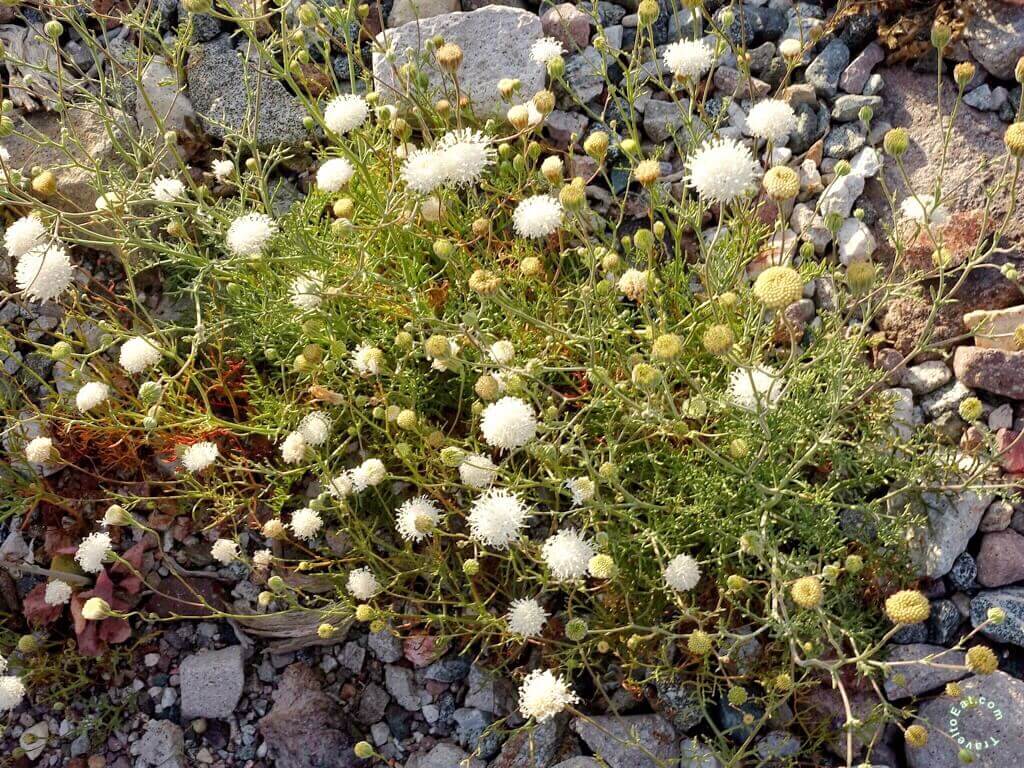
Past Badwater Basin


Just past Badwater Basin at about marker 24 or 24 miles past Furnace Creek Inn, the flowers really begin to take over and the many, many photographers appear in droves. This year they are out in full force due to the first “super-bloom” since 2005.
Sunset


As we returned to Las Vegas through the Amargosa valley, the sun was setting and I snapped a few photos. As always, I hope you enjoyed the post, please leave a comment.
[mappress mapid=”157″]
References:
San Andreas Fault: http://www.livescience.com/45294-san-andreas-fault.html
Plate Techtonics: http://www.ucmp.berkeley.edu/geology/tectonics.html
Earthquake Basics: http://www.conservation.ca.gov/cgs/information/outreach/Documents/discovery_basics.pdf
Death Valley Map: http://www.usgennet.org/usa/ca/state1/dvalley/map.html
Echo Canyon: http://www.gbr.4wdtrips.net/4×4/echo.html
Geology of Death Valley: https://en.m.wikipedia.org/wiki/Geology_of_the_Death_Valley_area
Beyond San Andreas: http://blog.esurance.com/beyond-san-andreas-5-scariest-fault-lines-in-the-u-s/
Corvus Gold: http://www.corvusgold.com/projects/nevada/nbf/
Desert USA: http://www.desertusa.com/dv/du_dvpdesc.html